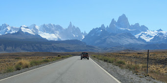
Mount Fitz Roy and surrounding peaks on the border between Argentina and Chile.
(Photo: Ben Tiger)
The icefields that stretch for hundreds of miles atop the Andes in Chile and Argentina are melting at some of the fastest rates on the planet. The ground that was beneath this ice is rising as these glaciers disappear.
These particular mantle conditions are driving many of the recent changes that have been observed in Patagonia, including the rapid uplift in certain areas once covered by ice.
Wiens specializes in seismology and geophysics and has done extensive research on large deep earthquakes in the Pacific Ocean, the effect of ice melt, and the seismology of Antarctica.
Geologists have discovered a link between recent ice mass loss, rapid rock uplift and a gap between tectonic plates that underlie Patagonia.
Scientists at Washington University in St. Louis, led by seismologist Douglas Wiens, the Robert S. Brookings Distinguished Professor in Arts & Sciences, recently completed one of the first seismic studies of the Patagonian Andes. In a new publication in the journal Geophysical Research Letters, they describe and map out local subsurface dynamics.
Shrinking icefields have reduced weight that previously caused the continent to flex downward. The scientists found very low seismic velocity within and around the gap, as well as a thinning of the rigid lithosphere overlying the gap. The ongoing movement of land is known as glacial isostatic adjustment.
Scientists at Washington University in St. Louis, led by seismologist Douglas Wiens, the Robert S. Brookings Distinguished Professor in Arts & Sciences, recently completed one of the first seismic studies of the Patagonian Andes. In a new publication in the journal Geophysical Research Letters, they describe and map out local subsurface dynamics.
These particular mantle conditions are driving many of the recent changes that have been observed in Patagonia, including the rapid uplift in certain areas once covered by ice.
Researcher Wiens reports, "Low viscosities mean that the mantle responds to deglaciation on the time scale of tens of years, rather than thousands of years, as we observe in Canada for example." Wiens explains, "This explains why GPS has measured large uplift due to the loss of ice mass.
"Another significant thing is that the viscosity is higher beneath the southern part of the Southern Patagonia Icefield compared to the Northern Patagonia Icefield, which helps to explain why uplift rates vary from north to south," Wiens said.
"Another significant thing is that the viscosity is higher beneath the southern part of the Southern Patagonia Icefield compared to the Northern Patagonia Icefield, which helps to explain why uplift rates vary from north to south," Wiens said.


No comments:
Post a Comment